
|
|
|
|
|||||
|
|
|
|
|
|
|||
|
Long-range Ocean Acoustic Propagation Experiment (LOAPEX) |
||
|
The experiment suspended an acoustic source from the R/V Melville at several locations in the eastern Pacific, and utilized the NPAL assets that were installed by APL-UW during the Acoustic Thermometry of Ocean Climate (ATOC) demonstration. LOAPEX had three primary scientific objectives:
|
|
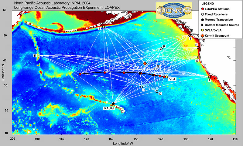 The seven red dots along the black LOAPEX cruise path indicate locations from which a low-frequency acoustic source was suspended at various depths from the R/V Melville. An eighth position was taken near the Kauai acoustic source. The open circles labeled with alphabetical letters represent permanent hydrophone arrays of the NPAL network. The red diamond represents the area of seamounts that were studied during BASSEX. The yellow dot shows the location of two vertical line arrays. The white lines indicate the geodetic paths between source locations and receivers. |
||||
Home | Experiments & Data | People | Workshops & Publications | Collaborations © 2006 Applied Physics Laboratory-University of Washington |